 |
|
|
| |
|
|
|
|
|
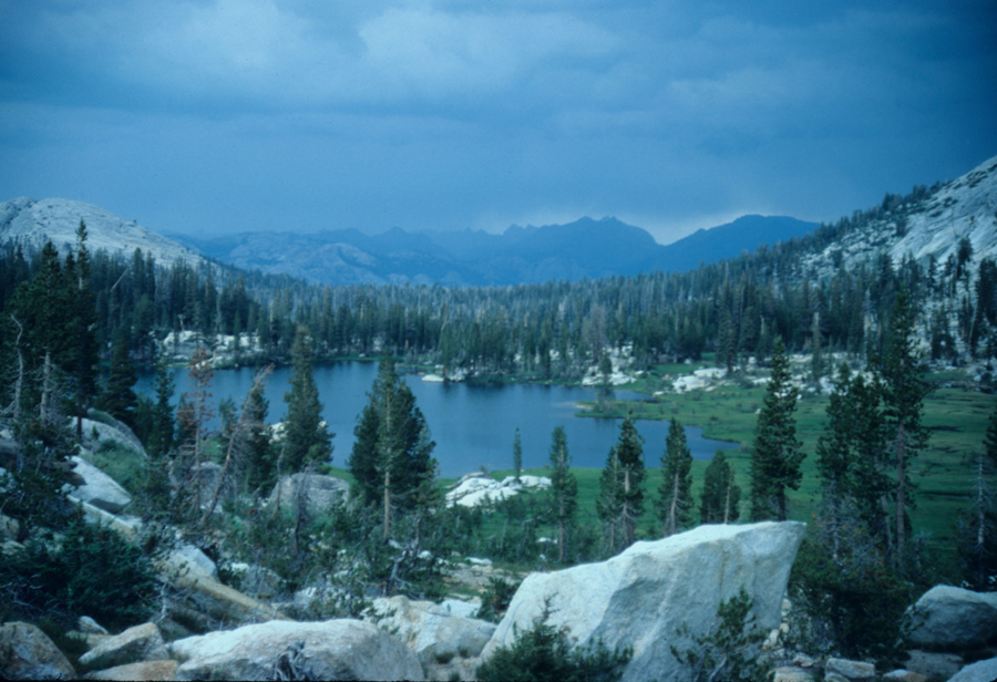
Most people visiting Yosemite only get a few feet from the road, and miss the true beauty of Yosemite. Yes, there are some great views in Yosemite Valley, but I think the best views are the ones I have to work for. One thing that sets Yosemite apart from other parks is the trail system, with over 800 miles of trails. Unlike some parks such as Rocky Mountain National Park with its short dead end trails, in Yosemite you'll have numrous options for loop hikes, never having to double back. You go go hiking a week every year and still not hike the same trail for a number of years. I've hiked about 2/3rds of the trails in the park over a period of about 25 years, some of those trails I've hiked multiple times. My pictures should help you decide where you want to go. Since I have so many pictures of the backcountry in Yosemite I've decided to split them into two sections using Highway 120 as the dividing line. Transportation: One convient way to make a loop in Yosemite is to leave your car in Yosmite Valley and take the bus to Tuolumne Meadows. You can also have the driver drop you off at any point along the road, or wave him down when he passes. This bus usually starts to run around the beginning of July (depending on snow) and runs till Labor Day weekend. There is also a free shuttle van that runs between Tenaya Lake and Tuolumne Meadows during this period. There is no overnight parking allowed on Highway 120 after October 15th, as the road closes with the first good snowstorm. Parking can be a problem in the Valley (and Tuolumne Meadows) not to mention the problem with bears breaking into cars. Public Transportation can also be used to hike the Tahoe Yosemite Trail or the John Muir Trail. To learn more about public transportation options to get to Yosemite and other areas on the Sierras see my pages on public transportation. While most trails in the park are in good shape, there are some trails that need help. Those trails are the ones that don't see as much traffic, and are far from the road. I'm hoping that a recent increase in fees will change that in the future. These trails are still easily passable, but care needs to be taken to ensure you don't step on a loose rock. The worst trails I've seen are in the Triple Creek area (the headwaters of the Merced River) and along the High Trail above Triple Creek. One of my favorite areas, and one of the least visited. If there's enought water in September to visit this area its possible you won't see anyone. In October you could probably hike a week in some areas and not see a sole, but water will be even harder to find. PERMITS:
To hike in Yosemite you'll need a permit. 60% of the permits
can be reserved in advance, with the remaining permits available
on a first come first serve basis starting the day prior. If
you're taking the bus to Tuolumne Meadows and have reserved a
permit, call the day prior to let them know you'll be there.
The bus won't arrive till about 10:30, and they'll start giving
those no show permits out at 10:00. This applies to other permit
stations also. There is a quota for trailheads. If you try to
get a permit for a busy trailhead you may not get it. The Happy
Isles and Tuolumne Meadows permits are some of the hardest to
get. You get a permit for Happy Isles that allows you to pass
through to Sunrise or Merced Lake. Don't expect to be able to
stay at Little Yosemite Valley anway, as there are rangers at
Little Yosemite Valley. You can expect them to come around checking
permits. Personally I don't like staying at Little Yosemite Valley
anyway. If you're hiking from one of the surounding wilderness
areas into Yosemite, the rangers from those areas will call Yosemite.
You don't need to worry about getting a seperate permit. Yosemite
has an excellent webpage where you see the quotas remaining etc. WHERE TO STAY PRIOR TO OR AFTER THE
HIKE. Yosemite has several campgrounds
reserved for backpackers. You may stay one night at these campgrounds,
and to do so you'll need a hiking permit. Cost is only 5$ per
person so why pay for a hotel. Camp 4 is another campground that
is cheap but it fills quickly. Many of the climbers stay here,
as well as a lot of foreigners which is why I like it. Its a
great place to meet people from all over the world. 6 people
are assigned to a site, and if there are sites with less than
6 you will be mixed in with them. Weekends can get noisy, but
the ranger will probably come around to quiet things down. Camp
4 is on the National Register of Historic Places because of its
signicance to rock climbing. Bear Boxes are provided. There is
also a backpackers campground at Tuolumne Meadows as well as
White Wolf and Hetch Hetchy. You'll need a hiking permit to stay
at any of these places. BEARS - New for 2008. You can no longer hang food in Yosemite. You must use either a bear canister, or use bear boxes when available. These canisters can be rented in the park for 5 dollars per hike. A 75 dollar deposit is required, which amounted to writing your credit card info on the paperwork for the canister when I did it. You can bring your own canister if you have one, but it must be an approved container. To find out which canisters are approved check the sierrawildbear.gov website. This is an single source website that controls information for the parks in California to make it easy for hikers.
WHEN TO GO ? There is no good answer to this question. It depends on a number of factors but the number one concern is snow. Normally you can go hiking by the end of July into September, but too much or too little snow changes that. If there is a heavy snow pack with a cool spring and late summer the snow won't melt. There could be a heavy snow pack but a hot spring and all that snow will melt early. You may think thats a good thing, but only if you're able to change your plans and go hiking earlier than expected. If you wait too long the creeks dry up and you'll have trouble finding water if you're expecting to get your water from these small creeks. Go too early and you'll be hiking in snow and muddy trails, and plenty of mosquitos. At least you'll find plenty of water but you may not enjoy your hike. If you can be flexible you'll need to keep an eye on the weather to see what the temperatures are doing. You'll also want to watch the California Snow Page to see how much snow there is in the mountains. Remember, what you're looking at on these pages is inches of water in the snow, not the snow pack. The actual snow pack could be 3 times what you're seeing. On the site you'll scroll down to the bottom and click on a river basin you're interested in. If you're looking for Yosemite you'll be wanting to look at the Tuolumne and Merced Rivers. Maybe wait at least a month after the levels reach zero. If in doubt, call the rangers at Yosemite. Live view of Yosemite Valley, follow their link back to the Yosemite Associations home page for more info, including Farely, my favorite cartoon located in the Newsroom.
If you're looking for books on Yosemite my favorite authors are Jeffrey P. Schaffer, Lew & Ginny Clark and Thomas Winnett. For maps I prefer the Harrison maps. I've found some error on the Trails Illustrated map in the area north of Yosemite (the trail had been moved away from the river for several miles), and even after notifying them 10 years ago, it still hasn't been corrected. I try to avoid Falcon books. Unless you have a seperate map of the area covered by the book you'll have a difficult time putting a hike togeather. Thats ok if you're happy doing only the hike as outlined in their books. I've also seen hikes listed in their books that are on trails closed in summer in they're Minnesota books. Something they don't point out. |
| |
|
|
