 |
|
|

|
|
| |
|
|
|
|
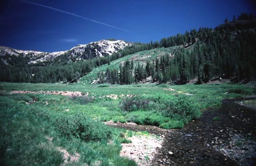
| The trail ends here and the hardest of the cross country routes starts. I went up the open area in the center of the picture to the top and then followed the ridge around to St Marys Pass. The Forest Service Map showed a trail which doesn't exist going straight up the canyon in the left of the picture. The hardest part of the route I took was that you have to lift your feet up higher to clear the plants. The 10,000 ft elevation doesn't help either. Looking at the map I think going up through the clearing is the best option as its a more gradual climb. The map indicates that the area in the left of the picture is much steeper. There weren't too many ducks to mark the trail when I was here. Either that or I just missed them. |
| |
|
|